Interview with Dr.Tetsuo Yanagi
 |
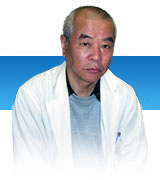
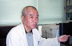
Dr.Tetsuo Yanagi Kyoto University, Doctor of Science Research Institute for Applied Mechanics Kyushu University <Major research themes> 2004.04 – 2005.03 : Primary production mechanism in the East China Sea 2003.04 – 2003.12 : Open-sea sourced Phosphorous and Nitrogen in the Seto Inland Sea 2001.04 – 2003.12 : Material cycling in the Japan Sea 2001.04 – 2001.03 : Inter-annual variation in circulation in Ariake Bay |
| What are your thoughts on the significance of the monitoring of the marine environment? | |
| If you don’t monitor the ocean, then you have no clue about the changes in the marine environment. It is important to understand and grasp the complex principles underpinning these marine changes for predicting changes in the future. Monitoring itself involves low-key work but it needs to be carried out accurately over a long period of time. Satellite retrieved data can pick up on the long-term changes the use of which will be crucial in the future. |
| Professor Yanagi, much of your research seems to have had to do with the coastal environment. What leads you to focus on coastal areas? | |
| I am attracted to coastal environments because these are the areas of the ocean with which human life is most intimately connected such that if a red tide breaks out and people are unable to catch fish, then this has a major impact their lives. Apart from that, I think this is a key area upon which academia must place emphasis because of its unique characteristics in terms of physical attributes, such as currents and waves as well as the high concentration distribution of nutrients, most notably phosphorous and nitrogen, that impacts the ecosystem. |
| Please tell us about the research that you have pursued. | |
 In terms of research utilizing satellite data, I have started research on Tokyo Bay and Bohai Sea. I am primarily using NOAA visible-band data, water temperature data and chlorophyll concentration data. I am researching the flow of water in the Bohai Sea. In terms of research utilizing satellite data, I have started research on Tokyo Bay and Bohai Sea. I am primarily using NOAA visible-band data, water temperature data and chlorophyll concentration data. I am researching the flow of water in the Bohai Sea.Aside from that, another project of mine involved the recent discovery that the Kanmon Straits’ current flows on average toward the west which was demonstrated using a physical model.In the Bohai Sea, I have succeeded in developing a method for systematically monitoring turbid water by standardizing NOAA’s visible satellite imagery (assigning the mouth of the Yellow River’s a pollution rating of 0 forming the base of the scale and the exit of the Bohai Sea Bay a value of 10). From NOAA’s water temperature data, I have found that the deeper areas of the Bohai Bay have a tendency to warm faster than the shallower parts of the bay. This is a new discovery and differs from the conventional knowledge that the temperature of coastal water areas tend to rise. I speculate that this is probably the effect of the Kuroshio. It is not possible to entirely solve the why and how behind this phenomenon simply from satellite data, but research is now being conducted using models designed to recreate the phenomenon that we have observed. In addition, we are also using the satellite data for chlorophyll monitoring. We are using MODIS data for the chlorophyll concentration monitoring; comparing satellite derived primary production data with the ecosystem model that we have established. We are aiming to illuminate the characteristics of this ecosystem using a three-pronged approach including a physical model, satellite data and on-site observation. I believe that to devise a good model, satellite data is essential in terms of time resolution and spatial resolution. |
| Currently, exactly what kind of satellite data are you using? | |
| I am using sea-surface altitude, water temperature and ocean color data. |
| What are your expectations for remote satellite sensing? | |
| It would be nice if satellite data could tell us salinity. Moreover, the current level of time resolution for the marine surface is low and I would like to see this improved. Especially given the rapid change that can be seen in a coastal environment in just one day, it is clear that monitoring with a high level of time resolution is needed. In regard to data distribution, any improvement in the delivery speed of the final product, such that we could obtain it in real time, would be great. I also feel that it is important to open data to the public as this will result in a more diversified base of users. |
| Specifically, what kind of potential users are there? | |
| Currently, the data is used for fishing. I also think there is a possibility that municipalities could use it. Furthermore, with the addition of surface temperature and wind forecasts, satellite data could be used for marine recreation such as fishing, yachting and surfing. Toward that end, I suppose it is important to create an environment that is easy for end users. Moreover, I also think the need for satellite data exists in the fishing sector in terms of resource management. It may be important to supply tidal information for fishing vessels to minimize their movement. I also think that satellite data can be used to prevent overfishing. |
| What research holds your interest currently? | |
| Right now, on my research group’s website we have publicized the results of the chlorophyll model that we have designed based on the OCTS chlorophyll concentration data. In the future, we want to use satellite data for chlorophyll concentration projections in a way that they will be automatically renewed on a daily basis. Areas with high chlorophyll concentrations have demonstrated a tendency to move toward higher latitudes in the spring. I call this phenomenon the cherry blossom blooming front in the ocean. |
| Can you tell us what first prompted you to use satellite data and if there were any particular, noteworthy struggles you faced initially? | |
| Initially, it all started when I was researching Tokyo Bay and Ise Bay, principally through on-site monitoring, and got my hands on NOAA water temperature data. At that time, NOAA’s (water) temperature data was quite expensive, something like several tens of thousands of yen per scene. The situation was nothing like today where you can use the information for free. Initially, I didn’t trust the satellite data, but in the process of using TRMM, TOPEX and ERS data, I came to understand the usefulness of satellite data. On-site monitoring only yields point-specific information whereas with satellite data there is the immense merit of being able to monitor a very expansive area. |
( Interview date: April 10, 2005)
Student interview
 |
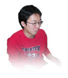
Hideki Miyamoto M2 Fukuoka University Engineering Division Civil Engineering Graduate Course Kyushu University Applied Dynamics Research Center Yanagi Research Group |
| What motivated you to join the research group? | |
| In my department as an undergraduate, I was part of the civil engineering division and studied water circulation. I became interested in models related to chlorophyll and wanted to conduct more specialized research in this area so I joined the research group. |
| What is your current research theme? | |
| I am working on a numerical simulation of the water cycle along the Philippine coast. I am not directly using satellite data, but I am interested in such data and reading research reports which rely on satellite data. As I continue with my research, if a chance to apply satellite data presents itself, by all means, I would like to make use of such data. Right now, I am interested in the MODIS chlorophyll data.。 |
| What expectations do you have in regard to satellite data? | |
| In continuing my research, vertical distribution-related information will be important. If I could acquire information that estimates the marine vertical distribution using satellite data, it could potentially be very helpful. |
( Interview date: April 10, 2005 )