Interview with Dr.Ichio Asanuma
 |
Dr.Ichio Asanuma Professor, Doctor of Engineering(Chiba Univ.) Department of environmental information Tokyo University of Information Sciences <Major research theme> Research on the primary productivity model of phytoplankton |
| Please tell us about the research topics that you are tackling. | |
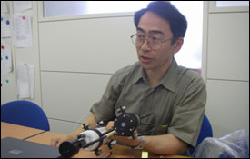
| Speaking in terms of remote sensing, our mission as an academic department is to use MODIS data as installed in Terra and Aqua. How to use this data is the predominant theme of our work. Apart from the university research budget that we receive, we have obtained frontier research budget funding from the central government and we are monitoring environmental changes in the East Asia region using data received at MODIS data acquisition centers that have been set up. Specifically in terms of the East Asia region, our research team is focusing on water that feeds from the Yangtze River into the East China Sea to try to determine the effect of this water downstream, such as research to assess its effects on the productivity of phytoplankton. As one component of this research, as part of a survey of the East China Sea thrice yearly on-site surveys of Yonakunijima, Yakushima (Island) and the area Tsushima are conducted. These surveys consist of a CTD profiling followed by water sampling at depths of 0, 10, 20, 30, and 50 meters. As part of the CTD survey, a sensor called PAR is attached to a compact type of CTD so that photosynthetically active radiation can be measured in conjunction with the survey. Using this, we are able to investigate the water temperature, salinity for active layers, take phytoplankton distribution data and the relationship between the surface and the euphotic zone. Chlorophyll is analyzed via water samples. Recently we have analyzed the data so that we are beginning to see the effects of river water of the Yangtze River on the ocean. |
| In what way do you look for ships used in the survey? | |
| When trying to survey Yonakunijima, Tsushima and Yakushima (Island) in the short period, we don’t have enough capacity to operate big research vessels. As a result, we charter small fishing boats, which are available on web sits as pleasure boats for fishing, at each islands for our survey with their supports. |
| Please tell us what got you involved with remote sensing? | |
 When I was an undergraduate student, I belonged to the engineering department and studied photographic engineering. Here I came into contact with a professor conducting digital image processing research. Training outside of the university involved my going to IBM and processing images unlike the way we do it today by inputting data using punch cards. Then I had an opportunity to handle satellite data obtained by NASAs earth monitoring satellite, LANDSAT. When I was an undergraduate student, I belonged to the engineering department and studied photographic engineering. Here I came into contact with a professor conducting digital image processing research. Training outside of the university involved my going to IBM and processing images unlike the way we do it today by inputting data using punch cards. Then I had an opportunity to handle satellite data obtained by NASAs earth monitoring satellite, LANDSAT.At that time, we were researching the use of LANDSAT data in conjunction with agriculture, vegetation and soil. While I was working on this research, a person from a company affiliated with the computer I was using told me that there was a computer that it had delivered to the Japan Marine Science and Technology Center (currently the Japan Agency for Marine-Earth Science and Technology) that wasnt working and that he wanted me to work on and it was starting this part-time position that got me involved with the ocean. |
| For what area or element of remote sensing do you have high expectations for the future? | |
| I would like to expect that remote sensing will be able to measure salinity concentrations and the mixed surface layer. However, I regard remote sensing data as purely a means of supplementing on-site data. At the Tokyo University of Information Sciences, we stress hands on practical studies and studying on-site. I think that for students this is a very good thing. By only using remote sensing data and never seeing the site itself, I think there is a risk of mistakenly interpreting the data. So given this and another merits, I think that remote sensing and on-site data gathering will both remain essential. |
(Interview date: June 21, 2006 )
学生さん インタビュー
 |
Motoki Gunji Tokyo University of Information Sciences Department of Environmental Information Department, Junior Member of Professor Asanuma’s Research Group |
| Please tell us what led you to choose to study with Professor Asanuma. | |
| I am interested in the climate and formation and movement of typhoons and wanted to learn about the mechanism behind how typhoons form at sea. At this school, research applying remote sensing and GIS is robust, but most of this has to do with land-based research. Professor Asanuma was the only individual dealing with the ocean so I decided to join his research group. |
| Please tell us what aroused your interest in typhoons. | |
| I have interested in taking pictures for a long time. I’m interested in the sky, clouds and the climate. When I was investigating typhoons, I became deeply interested in the way that typhoon winds move and the eye of a typhoon. |
| Please tell us what you expect from satellite data in the future. | |
| I would like to investigate the relationship between the way that ocean temperatures and currents change when a typhoon occurs so I would like to use satellite data toward this end. |
(Interview date: June 21, 2006 )