Interview with Dr.Hironori Fujishima
 |
Dr.Hironori Fujishima Water Quality Section,Toyama Prefectural Environmental Science Research Center <Major research themes> Dissolved organic matter in Toyama Bay |
| Please tell us about water quality surveys of Toyama Prefectural Environmental Science Research Center. | |
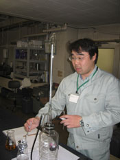
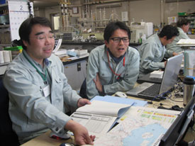 We, Toyama Prefectural Environmental Science Research Center, conduct the survey on the water quality of rivers, lakes, and the ocean. We, Toyama Prefectural Environmental Science Research Center, conduct the survey on the water quality of rivers, lakes, and the ocean.The survey on the ocean is implemented every month at 25 fixed stations in the coastal areas to obtain data of COD (Chemical Oxygen Demand), which shows the amount of organic matters in water and used as an indicator of the water quality, and concentrations of nitrogen or phosphorus. About 10 years ago in Toyama Bay, COD became very high temporarily, and its reason was reported as overgrowth of phytoplankton at the summer time. Therefore, since 1997, we have conducted the monthly observation on the concentration of chlorophyll a, which represents phytoplankton biomass in water, for the 9 stations; 7 stations at major river estuaries out of the 25 fixed station, 1 station at the center of the bay and the open sea.。 |
| How is the remote sensing data utilized in your center? | |
| The data obtained from water sampling shows only a point of information in the huge ocean, and therefore, it often miss high concentration of phytoplankton distributed several dozen meters away. As a matter of fact, data obtained at the west side and the east side of Toyama Bay sometimes shows significant difference. On the other hand, observation by satellite remote sensing enables monitoring of huge area of the ocean in a moment. So when the data obtained from the field are significantly different between stations at the west and the east, we look up Chl-a distribution of a satellite image to objectively validate reliability of the field data. Thus, we use the satellite remote sensing data to validate reliability of data of sampling from the field. |
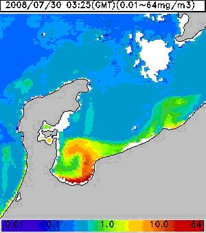
Fig. 1: Image of chlorophyll a concentration on July 30, 2008.
Its concentration varies widely between the west and the east of the bay.
| What is your requirements or expectations for the satellite remote sensing techniques? | |
 Sea surface temperature and the chlorophyll a concentration are now generally used. But, I think it would be more useful if data on salinity become available, since it could help us understand the spread of fresh water from rivers in the ocean. We sometimes observed very low salinity at the sea surface layer in the center of Toyama Bay at the summer time. In such a case, data measured often show anomalies, and it makes us hard to trust the reliability of those measure data. Sea surface temperature and the chlorophyll a concentration are now generally used. But, I think it would be more useful if data on salinity become available, since it could help us understand the spread of fresh water from rivers in the ocean. We sometimes observed very low salinity at the sea surface layer in the center of Toyama Bay at the summer time. In such a case, data measured often show anomalies, and it makes us hard to trust the reliability of those measure data.Recently, I hear that satellite observed Colored Dissolved Organic Matters (CDOM) is enabling estimation of salinity. If accessibility to such data becomes available on a regular basis, I believe it will expand places to utilize satellite remote sensing techniques. |
(Interview date: March, 2009)