 |
MapseagrassMapseagrass is a multi-institutional project involving international organizations, universities, research institutes, NGOs and technology companies that have come together to contribute to understanding transformation of seagrass habitats in coastal waters through a near real time mapping from space. |
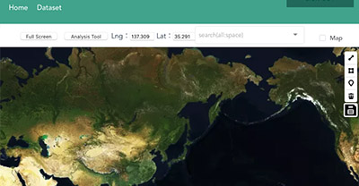 |
Seagrass MapperSeagrass Mapper is a cloud-based tool for mapping seagrass distribution using satellite images and field based information. The Seagrass Mapper is constructed on Google Earth Engine and it can interactively map distribution of seagrass in coastal water. |
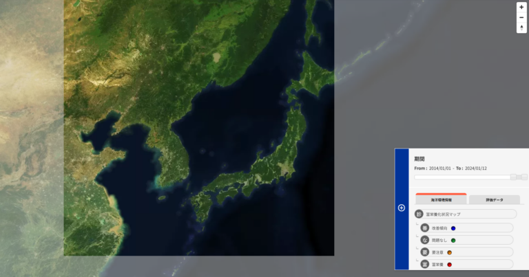 |
CEARAC Web-GISCEARAC Web-GIS visualizes the state of the marine environment in the Northwest Pacific region (NOWPAP region) based on information provided by China, Japan, Korea, and Russia. Information on eutrophication status, seagrass distribution, COD ( Chemical Oxygen Demand ), red tide occurrence, hypoxia occurrence, satellite chlorophyll a (east side, west side), tidal flats are mapped on the map along with colors and numbers, allowing users to quickly understand the changes in the environment. |