Case studies > Prof. Hajime CHIBA Interview
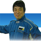 |
Prof. Hajime CHIBA Department of Maritime Technology, Toyama National College of Technology < Major research themes> Understanding water mass structure in Toyama Bay by in-situ monitoring data |
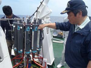
Inspecting CTD equipped on “Wakashio Maru”
| What are major studies of your laboratory? | |
| In my laboratory group, we conduct monthly CTD monitoring in Toyama Bay, using our training ship, “Wakashio Maru” to observe salinity, water temperature and pressure (depth) of the sea on regular basis. Obtained data are used to analyze the water temperature (from the surface layer to the bottom layer), vertical distribution and seasonal variation of salinity in the entire bay as well as the flow of the Tsushima Warm Current. The results of the analysis can contribute to promotion of fisheries, navigation of vessels and disaster prevention. |
| How do you use satellite data? | |
| As only point data are obtained by CTD monitoring, we have to spread out those obtained point data to get non-point information for wider area. While CTD monitoring can obtain vertical data by depth, satellite data can cover wider surface areas of the sea. So, satellite data can complement spatial limitation of in-situ monitoring data. CTD data can supply underwater information to satellite data vice versa and compliment monitoring data. |
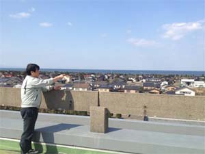
Rooftop of Toyama National College of Technology, where a full view of Toyama Bay can be seen
| What is your expectation for satellite data? | |
| In our in-situ observation at the fixed site (10 kilometers from the coast line), monitoring results of water transparency and water color are always different. This may be due to input and diffusion of river water in the sea. If satellite data can help identify the cause(s) of such phenomenon, it is very useful. In that sense, I expect to obtain real-time salinity data. |
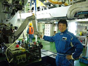
Before a submersible survey in the west Hokkaido sea area with “Shinkai 6500” aboard the mothership “Yokosuka” (June 2008)
(Interviewed on 27 March 2012)
Student interview
 |
Ms.Miho SUGIE 2nd grade in the Advanced Course (Maritime System Engineering Program), Toyama National College of Technology |
| What made you join Prof. Chiba’s laboratory? | |
| I belonged to the seminar on maritime accidents and researched on the causes in the 4th grade. Then, when deciding my graduation theme in the 5th grade, I chose “marine meteorology” which had been the most interesting subject for me among the undergraduate classes. |
| What are you studying now? | |
| I am studying meteorology, focusing on Toyama Bay. Toyama Bay has a very unique trilaminar structure: coastal surface water which is influenced by river water; the Tsushima Warm Current underneath; and Japan Sea Proper Water at the bottom. I’m intrigued by this complicated structure, and I have been using satellite data to understand the degree of impacts by river water to the coastal surface water. |
| What are your future plan and expectation for satellite data? | |
| I will be an operator at a port operation center in Tokyo, Nagoya or Osaka, where marine transportation is quite heavy. Perhaps I need to communicate with foreign vessel crews in English at work, so I will study English hard. Then, I need to understand how to read real-time meteorological information and decide the necessary action at work and my current study will be fully utilized. So, I would like to expand my knowledge as much as possible in Prof. Chiba¡Çs laboratory. |
(Interviewed on 27 March 2012)